
10

Superior Hiking Trail | Guide to Backpacking Campsites
Way to Camp # 10 | Backpack Camping on a National Scenic Trail
The Public Land:
The Superior Hiking Trail.
This 310 mile, wilderness character hiking path traverses the highlands of Minnesota's north shore of Lake Superior. From a northern terminus on the Canadian border, to a southern terminus below the city of Duluth this continuous footpath creates access to
Is it fair to label the Superior Hiking Trail a public land?
The trail deservedly occupies the mind as a singular outdoor recreation destination, owing to the successful branding and communications efforts of the Superior Hiking Trail Association, the non-profit who manages it. While it traverses many different lands belonging to local, state, federal and private owners, it is formally an included segment of the much longer North Country National Scenic Trail. As a section of a federally designated national scenic trail, its complicated but fair enough to consider it, at least, a specific amenity of our public lands system.
Approach :
The Draw: The best backpacking experience Minnesota can offer.
Framed by the cultural institution that is American backpacking, long distance multi day National Scenic Trails (social,
the Superior Hiking Trail is Minnesota's response - on its own a highly renowned backpacking destination,
contextually, A great entry level backpacking experience to prepare for anywhere else in the world.
"Wilderness Character": Remoteness without high risk.
Nearly always surrounded by protected natural areas, and almost always feeling remote, in truth the hiker is never very far away from a trailhead.
-
Camping so close to scenic, high volume rivers and cascades really only happens at the campsites on this trail.
Of Minnesota Camp Guide's 23 Ways to Camp on Minnesota Public Lands, the Superior Hiking Trail includes the following:
#10. Backpack Camping on a National Scenic Trail
Expected Use:
To serve as single overnight stays while multi-day hiking on this long distance trail.
Not destinations for weekend or longer stays.
Administrative :
1 Trail (or 2) 94 campsites $Free 0% reservable
The trail, including its bridges and campsites are built and maintained by the non-profit Superior Hiking Trail Association.
While the ground it crosses are owned by government agencies and private landowners the point of contact and the organization of staff and volunteers who are to thank most for this amazing piece of recreation infrastructure are the SHTA.
The ~310 mile Superior Hiking Trail existed before the Congressional designation of the North Country National Scenic Trail. The NCT corridor routes over and along many other existing trails including the SHT. While this website categorizes the SHT under the banner of a national scenic trail designation (because it is) the de facto administration of life on this trail is very much lead by the Superior Hiking Trail Association.
Backpack camping is only allowed at the designated campsites.
-
No camping is allowed at parking lots or at any undesignated sites.
-
No dispersed camping is allowed anywhere along the trail, despite traveling through state and national forests at times.
These campsites are free. No permits are required.
No reservations. Not even first come, first served!
Campsites must be shared. There is an expectation that any arriving hiker is absolutely allowed to amble on in and pitch their tent.
-
'Early birds' definitely get worms = the best pick of quality tent pads (flat, private, better views).
Etiquette:
Some notes; make your best attempt to respect the following:
-
Avoid setting your shelter directly adjacent to the fire ring and commons area.
-
First conflict is between others having a campfire and the safety of your tent from sparks/embers.
-
Second conflict is that best practice is to prep and eat food at commons areas and away from tents.
-
-
Respect the cleanliness of the drinking water source.
-
Rinse or wash upstream from where people gather and filter water.
-
Some water sources are not high volume or moving. Maybe don't rinse and wash things in these.
-
It's unavoidable that dirty feet have been rinsed in the same spot someone drinks from, maybe just try to keep it a secret.
-
-
Amenities & Skills :
Primitive , but popularly used backcountry campsite accommodations.
These campsites are primitive, backcountry accommodations meant to serve the business of completing a long hike on the trail.
These campsites are considered remote. Most do not have cell phone service. Having comfort and confidence in backcountry settings is necessary. That said, these are great for first experiences of remote backpacking. The front country roads and trailheads (especially in the central and southern portions) are within a mile or three at nearly all times.
☑ Cleared and level tent pad sites on natural substrate.
-
Anywhere from 2 - 8 depending on campsite size.
-
The first hikers to arrive get higher quality pads, and the quality descends to rootier, more rugged and less level options.
☑ A "commons area", surrounding:
☑ Rock fire rings.
☑ Wooden benches, or natural log seating.
☑ Backcountry pit latrines. Not enclosed and open to the elements, but located somewhere mostly private.
-
Do not throw anything except toilet paper into the latrines.
☐ Gather , filter and treat drinking water from a wild source. There is no potable water provided.
-
Most campsites are located on a dependable source of wild water. Some have sources that dry up in midsummer. Some have no source at all.
☐ Practice backcountry food and trash storage.
-
☐ No permanent bear boxes are installed.
-
Avoid all woodland critters, the local black bears included - by keeping all trash, food and scented hygiene products secure;
-
Correctly use bear hangs, bear barrels or bear bags.
-
Do not leave trash, food or cookware unattended.
-
-
Have trash bags and receptacles ready to pack out all of your garbage. Pack out what you pack in.
☐ Firewood is not provided. Gather sustainably. Collect only already dead and downed wood.
☐ Practice 'leave no trace' hygiene.
-
When rinsing off in water bodies do not use soap products directly in the water.
-
Biodegradeable soaps must be used in collected water away from the source, then dumped onto soil.
-
-
When disposing of gray/brown water - disperse in a wide cast that doesn't leave a concentrated residue.
-
Includes water if having washed dishes.
-
Particularly includes toothpaste spitting!
-


Why This Guide? And Other Resources.
When you're on thru-hike mode turned up to eleven, campsite selection is determined simply by which is nearest at the sun begins to set. The only variable that would move you forward or have kept you short is whether a site was completely dry of drinking water. This guide is no matter there.
When you are working the dials, even a little bit, towards comfort, enjoyment and 'optimizing' your trail experience you'll find yourself wishing and wondering you knew how this campsite you're at compares to the one up ahead? This guide is for those hikes.
Every awesome day on the hiking trail isn't always, but can be compounded by an evening and overnight in the backpacking campsites that are admittedly higher quality than others. [Every single campsite is an achievement of the Superior Hiking Trail Association volunteers, members and staff that I am beyond grateful to have. :)]
The purpose of this guide, in providing descriptions and a respectful comparative ranking (any night spent on the trail is 5 star!) is to identify and celebrate the best of the Superior Hiking Trail backpack camping experience. To that end, this resource supports the following trip goals:
-
Making the most out a section or thru-hike; where adjusting mileage is worth it for the more scenic or interesting campsite to end the day, having a long lunch break or taking a zero day.
-
Sampling the 'cream of the crop' for the ultimate hit-and-run experience of the best of what SHT backpack camping can offer on a single overnight or weekend outing. Time can be a limited resource. Or you've got new initiates to convince that more days on trail are well worthwhile.
★ 1 - 5 What are the criteria that impacts these rankings?
Most Impactful
-
Water. Always looking forward to water.
-
Moving water is better than still. Larger volume is better than smaller.
-
Large volumes of moving water allow rinsing, wading and swimming - high score. Small, still pools are for drinking water only.
-
Closer to the tent pads is much better. If I can hear it from tent, great. If I can see it from tent, the best.
-
Topography. Excellence is surrounding ground that is interesting (heights, slopes, hills, banks) but keeps the common areas and tent pads flat and level.
More Impactful
-
Quality of Tent Pads. I don't care about the substrate - until it rains. Then I wish for a grassy or otherwise organic bed to keep my tent from caking in what is now mud.
-
Trees. Mostly for aesthetics. The trail grants a variety of hardwoods and conifer mixes throughout, but I'm happier with open, airy and mature groves than the thick, claustrophobic stands of young aspen, spruce and alder. Sun and shade can be had at any site, and preferences completely depend on weather and season.
Less Impactful
-
Distance from main trail.
-
The view from the latrines.
Other Resources.
These are the official resources produced by the Superior Hiking Trail Association.
Minnesota Camp Guide presents the campsites on NPS river maps in the following format,
adding images, descriptions, hike-in/drive-in designations and a rating.
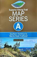
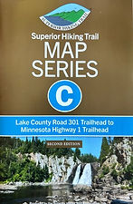
☑ The official trail Map Series from Superior Hiking Trail Association
☑ Superior Hiking Trail Databook from Superior Hiking Trail Association
☑ Guide to the Superior Hiking Trail from Superior Hiking Trail Association


The Campsites Catalog
The Superior Hiking Trail | Designated Campsites
F 294.9 Campsite Legend ★ 1
F (Map Series) 294.9 (Mile Marker Northbound) Campsite Name ★ 1 (Guidemaker's Rating)
A general description of the campsite. An impression of the place written by the guidemaker while seated there.
-
Water: ☑ Present. ☐ Not present.
-
⦿ Reliable throughout season, good flow. ⦿ Seasonally unreliable, low flow or low quality. ⦿ No water.
-
-
Size: As determined by SHTA. (S) Small: (M) Medium: (L) Large:
-
Tent Pads: Counted by guidemaker. A conservative count, not including the spots which are used as last resort.
-
-
Amenities: ☑ Pit latrine toilets and rock fire rings always present. ☐ Various arrangements of log/lumber benches surround common areas around fire ring.
-
Coordinates location of the campsite.
-
★ Less Remote: Campsites that are less than one mile from a trailhead receive a mention. This is to identify the most accessible or lower stakes out and back hike-in camping opportunities for first time outings or simple trips for testing gear shakedowns.
Map Series F: Northern Terminus to Pincushion Mountain Trailhead
F 294.9 Andy Creek ★ 1
A shallow rise in swampy alder-ground. Patchy balsam fir surrounds the commons area. A wide vista of campsite from the latrine.
-
☑⦿ Water: A small, alder choked creek. A little walk from campsite.
-
Size (S). Tent Pads: 3-4 of good quality.
-
☑ Pit latrine toilet. ☑ Rock fire ring. ☑ Two bench commons area.


F 289.8 Jackson Creek ★ 3
Past a gate of glacial erratics, into a dense forested height of land, thick with spruce and balsam. Rests just above a charming creek that enters a wetland, offering friendly access to light water.
-
☑ ⦿Water: A small creek.
-
Size (S). Tent Pads: 4-5 of good quality.
-
☑ Pit latrine toilet. ☑ Rock fire ring. ☑ Three bench commons area.
-
★ Less Remote: A little over one mile.


F 286.5 Caribou Pond ★ 2
On a rugged slope and in close quarters of thick balsam & spruce. An impressive beaver dam spills moving water, providing ambience. A 'semi-vista' when looking towards the pond.
-
☑ ⦿ Water: Most immediate access is the beaver pond. Moving water outflow is an option a little hike north, with some bush tramping.
-
Size (S). Tent Pads: 4-5 of good quality.
-
☑ Pit latrine toilet. ☑ Rock fire ring. ☑ Two bench commons area.